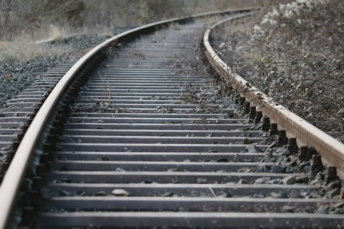
Norfolk's railway map once looked like a dropped ball of string. Lines ran from Norwich to almost every market town and every seaside resort, and rival companies fought over the traffic. Today the county keeps a handful of working routes, and most of the rest survive as footpaths, hedgerows, embankments, brick bridges spanning nothing at all, and station houses with a suspiciously platform-shaped footprint.
You don't need to be a trainspotter to enjoy any of it. You need an old map, a pair of boots, and the habit of looking twice at a suspiciously straight line of trees running across a field.
Why Norfolk Had So Many Lines, and Why They Went
Two things built the county's railways: farming and holidays. Goods traffic paid the bills for much of the year — sugar beet, cattle, coal, grain, fertiliser, milk — while summer excursion traffic to Cromer, Sheringham and Great Yarmouth filled the carriages and made the seaside branches look busier than they really were.
Competition made the network denser than it needed to be. Rival companies built parallel routes to the same towns, and several small lines were stitched together into longer cross-country routes. The most famous result was the Midland & Great Northern Joint Railway, a sprawling system that threaded its way across the county rather than into it.
The decline came in two waves. The M&GN's passenger services ended in 1959, before the Beeching report of 1963 and before most households had a car to fall back on. Then the 1960s cuts picked off the branches one by one, and a few survivors limped on: the King's Lynn to Hunstanton line, for instance, lasted until 1969. Villages that had two stations suddenly had none, and Norfolk's remaining routes settled into roughly the shape we know today.
Melton Constable and the M&GN
If you learn one name, learn this one. The Midland & Great Northern ran from the Midlands to the Norfolk coast, with a main line through Melton Constable, Fakenham, Aylsham, North Walsham and on towards Cromer and Great Yarmouth. It was never rich. It was, however, remarkably widespread.
Its engineering heart was Melton Constable, a village that briefly took on the character of a railway town, complete with its own works where locomotives and carriages were built and repaired. Local writing sometimes called it the Crewe of Norfolk, and the comparison made sense at the time. When passenger services stopped in 1959 and freight faded in the mid-1960s, the works went with them. The site is now an industrial estate, and the scale of what stood there is only really legible if you already know the story.
What's Actually Left in the Landscape
Remains fall into a handful of recognisable categories. Learn them and you'll start spotting old railways from a moving car.
- Trackbeds. Many have been reused as footpaths, bridleways, farm tracks and cycle routes. Look for a long, level corridor with hedges on both sides and gently curving alignment.
- Bridges and culverts. Brick and concrete structures carrying a lane over what is now a field, or a trackbed over a stream. These are often the most photogenic survivals.
- Embankments and cuttings. Earthworks that never got flattened because nobody needed the land badly enough. Some cuttings are now shaded green corridors full of ferns and foxgloves.
- Station buildings. A great many became private houses, offices or shops. The giveaway is a building sitting oddly far from the village centre, with tall windows, a canopy bracket or a chimney stack in the wrong place.
- Goods sheds, signal boxes and platforms. Platforms often survive as raised strips of brick or concrete in a garden boundary; goods sheds turn up as workshops and stores.
- The small stuff. Mileposts, boundary markers, cast-iron gateposts, squat stone posts along a field edge — the details that outlast everything else.
Named places worth a look include Wells-next-the-Sea, where the old station site now serves the Wells & Walsingham Light Railway, and Aylsham, where the terminus belongs to the narrow-gauge Bure Valley Railway. Dereham's station is the base of the Mid-Norfolk Railway. Swaffham's station building survives in other uses within the town, and Whitwell & Reepham station has been brought back to life beside the Marriott's Way. Norwich City station, tucked away on the north-west edge of the city, closed with the M&GN passenger services and its site has since been swallowed by roads and redevelopment.
Four Old Routes You Can Walk or Ride
- Marriott's Way. A path of roughly twenty miles from Norwich out to Aylsham and on towards Reepham, following the old M&GN alignment. Level, firm underfoot and easy to break into shorter sections.
- Weavers' Way. A long-distance route of around sixty miles from Cromer to Great Yarmouth that uses former railway corridors for much of its length. Best done in chunks unless you have a free weekend and sturdy legs.
- Bure Valley Path. Runs alongside the narrow-gauge Bure Valley Railway between Wroxham and Aylsham, so you get the landscape and working trains in the same walk.
- Paston Way. A footpath in north-east Norfolk that follows the corridor of the old Cromer to North Walsham line through villages such as Mundesley and Paston. Quiet, rolling and full of church towers.
Heritage Lines Keeping the Idea Alive
Some of the old routes never fully stopped being railways. The North Norfolk Railway runs standard-gauge steam services between Sheringham and Holt, with a station at Holt that is a reconstruction rather than the original building. The Mid-Norfolk Railway operates between Wymondham and Dereham and has long-standing ambitions to extend further. The Bure Valley and the Wells & Walsingham are narrow-gauge and minimum-gauge respectively, both built on trackbeds that once carried full-size trains. Whitwell & Reepham is a small, volunteer-run station with a cafe, which makes a sensible halfway stop on a Marriott's Way walk.
These lines are run by volunteers, so check running days before you travel. A sudden downpour or a shortage of signallers can change the timetable.
Before You Set Out: Practical Notes
- Use two maps. Compare a modern Ordnance Survey Explorer sheet with a Victorian or Edwardian map of the same square. The National Library of Scotland's online map viewer lets you overlay old and new, which is the fastest way to spot a vanished line.
- Look for "dismantled railway" on OS maps. It appears as a dashed line, often with a name such as Station Road nearby. A village with a Station Road and no station is usually a former halt.
- Stick to public rights of way. Trackbeds are frequently private land, and some are still in railway use. Never walk on or beside an open line.
- Respect the buildings. Converted stations and goods sheds are people's homes and businesses. Photograph from the road, not the kitchen window.
- Dress for the season. Former cuttings are mud baths in winter and nettle tunnels in July. Long trousers and proper boots beat trainers every time.
- Take water and a charged phone. Old alignments often run through stretches with no village, no signal and no handy pub for several miles.
The reward for a little preparation is a version of Norfolk most visitors never notice: a county with a second, invisible map laid over the first, visible in a bridge parapet, a line of trees, or a platform edge somebody now keeps their bins on.
Photo: manfredrichter / Pixabay